OUR EQUIPMENT / YOUR PROJECT
Meet the fleet.
See the possibilities.
Three aircraft. A purpose for every perspective. Explore the cameras and capabilities behind our aerial photography, mapping, and visual documentation.
01 / Aerial photography & video
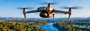
DJI Air 2S
A compact aircraft for property marketing, scenic imagery, and visual progress documentation. Its large sensor and flexible video formats make it a practical choice for compelling aerial storytelling.
Key specifications
- Main camera
- 1-inch CMOS · 20 MP
- Lens
- 22 mm equivalent · f/2.8
- Video
- 5.4K up to 30 fps · 4K up to 60 fps
- Still formats
- JPEG and DNG (RAW)
- Maximum flight time
- 31 minutes¹
- Aircraft weight
- 595 g
What this enables
Balanced imagery
Exposure bracketing provides source frames for HDR processing.
Property perspectives
Capture overhead, oblique, and surrounding-area views for a clearer sense of place.
Smooth aerial video
A stabilized camera supports property tours and site overview footage.
02 / Mapping & repeatable documentation
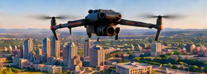
DJI Mavic 3E
An enterprise aircraft suited to mapping and construction documentation. A mechanical shutter helps reduce motion distortion when collecting the overlapping photographs used in photogrammetry.
Key specifications
- Main camera
- 4/3 CMOS · 20 MP
- Wide lens
- 24 mm equivalent · f/2.8–f/11
- Shutter
- Mechanical shutter up to 1/2000 s
- Video
- 4K up to 30 fps
- Maximum flight time
- 45 minutes¹
- Positioning
- Optional RTK module support²
What this enables
Mapping capture
Overlapping imagery can be processed into orthomosaics and 3D models.
Progress records
Planned routes help document site changes over multiple visits.
Flexible deliverables
RAW imagery supports processing for project-specific outputs.
03 / Advanced mapping & visual inspections
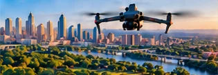
DJI Matrice 4E
A multi-camera enterprise platform for mapping, modeling, and detailed visual documentation. Wide, medium telephoto, and telephoto views provide site context and a closer look at individual features.
Key specifications
- Wide camera
- 4/3 CMOS · 20 MP · mechanical shutter
- Medium telephoto
- 48 MP · 70 mm equivalent
- Telephoto
- 48 MP · 168 mm equivalent
- Video
- 4K up to 30 fps
- Maximum flight time
- 49 minutes¹
- Additional capabilities
- RTK positioning support² · laser rangefinder
What this enables
Efficient mapping
Wide-camera capture intervals down to 0.5 seconds support dense image collection.
Detailed observations
Telephoto cameras provide closer views of rooftops and building features.
Spatial context
Rangefinding supports distance observations alongside imagery; this aircraft captures visible-light imagery.
AT A GLANCE
The right platform for the project
We select aircraft around your site, the imagery you need, and the intended deliverables.
| Capability | DJI Air 2S | DJI Mavic 3E | DJI Matrice 4E |
|---|---|---|---|
| Primary role | Photography & video | Mapping & documentation | Mapping & visual inspections |
| Main sensor | 1-inch / 20 MP | 4/3 / 20 MP | 4/3 / 20 MP |
| Mechanical shutter | No | Yes | Yes, wide camera |
| Maximum video | 5.4K / 30 fps | 4K / 30 fps | 4K / 30 fps |
| Maximum flight time¹ | 31 minutes | 45 minutes | 49 minutes |
¹ DJI maximum flight times are measured under controlled, windless conditions to battery depletion. Air 2S: 31 minutes; Mavic 3E: 45 minutes with the DJI Mavic 3 Series Intelligent Flight Battery and Enterprise propellers; Matrice 4E: 49 minutes with standard propellers (46 with low-noise propellers). Working flight time is shorter and varies with conditions, equipment, and battery reserves.
² RTK requires a suitable configuration and correction source. Accessory availability and the positioning workflow are confirmed for each project; aircraft positioning specifications do not guarantee final map accuracy.
Specifications describe manufacturer capabilities. Deliverables depend on mission planning, capture conditions, and processing. Sources are linked with each aircraft; reviewed October 30, 2026.
START WITH YOUR OBJECTIVE
Tell us what you need to see.
We’ll match the aircraft and capture approach to your project.
Discuss Your Project